
Geophysical exploration of the subsoil
Geophysical techniques provide virtual images of the subsoil that allow us to infer the structure of the geological materials and assess the presence of underground water. In the TRANSFER project, we have counted on the expertise and cooperation of the group on Environmental and Economic Geology and Hydrology (GEAH) of the University of Barcelona and B&B Geòlegs consulting to obtain profiles of the terrain by Electrical Resistivity Tomography (ERT).
 |
|
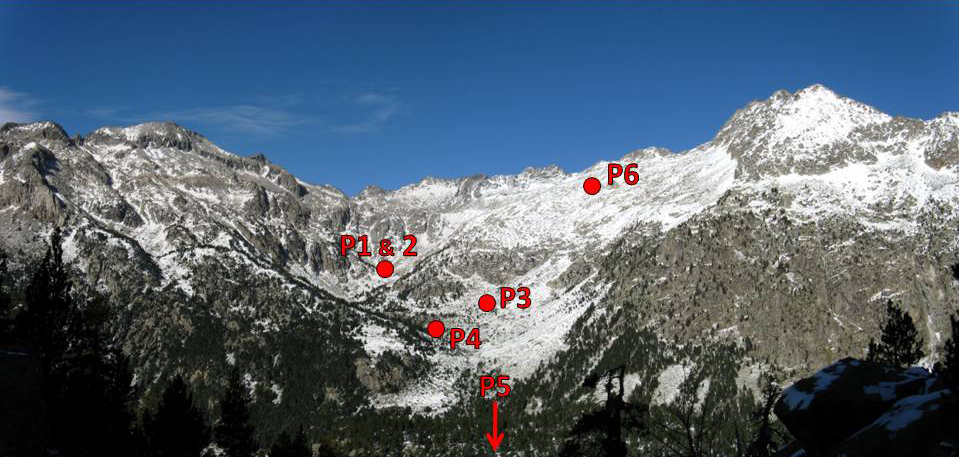
View of the Contraix catchment with indication of the location of the six ERT profiles |
 |
|
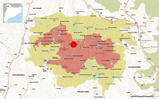
Location of the Contraix catchment within the boundaries of the Aigüestortes National Park |
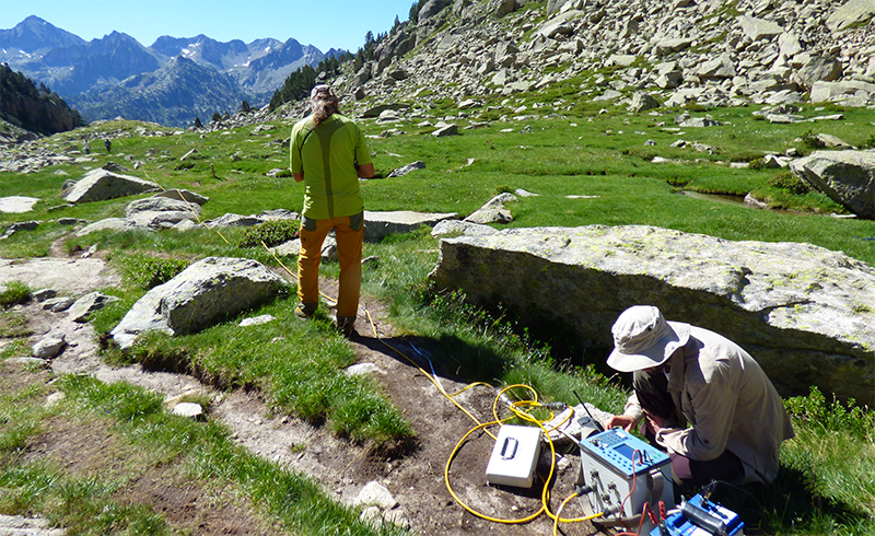
We have carried out these measurements in several areas in the Contraix catchment, from 2,000 to 2,700 m of elevation. The purpose was to search for deep aquifers. The ERT involves the insertion of electrodes 15-20 cm in the ground along a transect to introduce an electrical current in the terrain, and to measure the conductance (or its inverse, the resistivity) between electrodes. The resistivity depends mainly on the water content and the porosity of the materials. According to the distribution of resistivity, one can infer the structure of the subsoil and the presence of water.
In July and September 2017 we have carried out two field campaigns to take ERT profiles. The results show that underground water is abundant in the catchment, even in high elevation areas. A highly fractured granitic bedrock holds important aquifers with a freatic level at 20-30 m below the surface. In the bottom of the valley, glacial and lacustrine deposits act as underground water storages.
 |
|
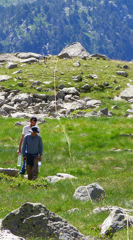
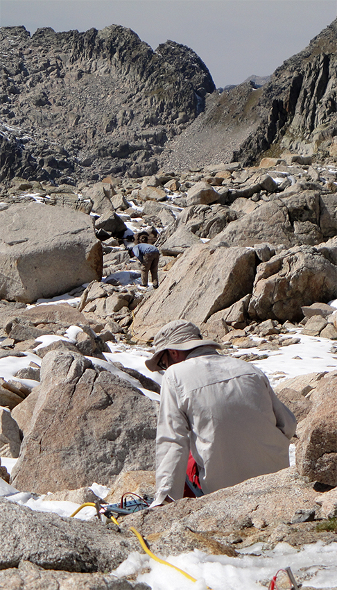
Working at the Cap de la Ribereta (2,300 m asl), where we measured profiles #1 and #2 |
 |
|
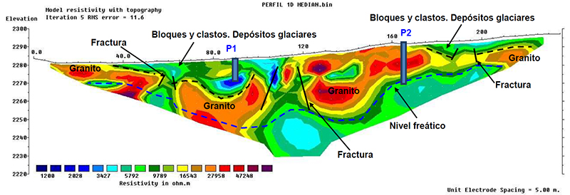
ERT profile #1. Blue colors indicate low resistivity areas with high porosity and water content. Red colors are high resistivity areas, in this case non-fractured granite. This profile was taken at the Cap de la Ribereta, a rocky plateau covered by a peatland and several rock outcrops. The profile indicates the existence of two aquifers: a deep one, with a freatic level around 20-30 m from the surface, and a shallower one at about 10 m below the surface. There are also three vertical fractures that can act as aquifer recharge areas. |
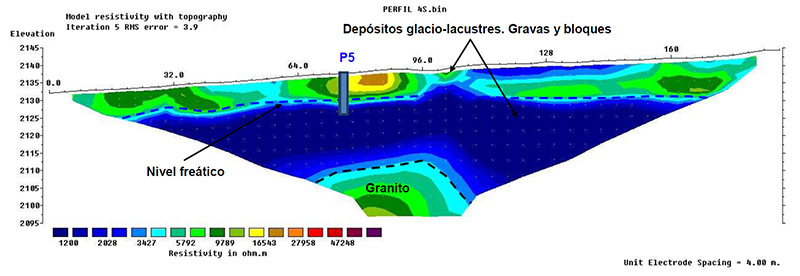 |
|
ERT profile #4. This profile was taken in a small plain formed by the acumulation of glacial and lacustrine deposits (gravels and rocks) in a boxed area at the bottom of the Conangles valley. These features of the terrain are very porous and may be important storages of water, as the plot shows. |
|
|
|
Working on profile #6 at the Estanys Gelats plateau (2,700 m asl) |
 |
 |
|
posted 13/02/2018 |