In 2008, the LTER-Aigüestortes node was established as a member of the recently created LTER-Spain.
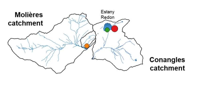
Long-term ecological research (LTER) and monitoring in Aigüestortes and Estany de Sant Maurici National Park is carried out under an agreement between several institutions: the Catalan Department of Territory, Housing and Ecological Transition, under whose jurisdiction the Park falls; the Spanish National Research Council (CSIC), through the Limnological Observatory of the Pyrenees of the Blanes Centre for Advanced Studies (LOOP-CEAB); the University of Barcelona through its departments of Plant Biology and Ecology and High-Mountain Research Centre (CRAM); the Centre for Ecological Research and Forestry Applications (CREAF); and the Autonomous University of Barcelona through its departments of Geography and Prehistory. The Aigüestortes long-term ecological research (LTER) and environmental monitoring cover nine areas (see the Figure).
- MISSION
Long-term ecological research (LTER) and monitoring in Aigüestortes and Estany de Sant Maurici National Park is carried out under an agreement between several institutions: the Catalan Ministry of Agriculture, Livestock, Fisheries, Food, and the Natural Environment, under whose jurisdiction the Park falls; the Spanish National Research Council (CSIC), through the Limnological Observatory of the Pyrenees of the Blanes Centre for Advanced Studies (LOOP-CEAB); the University of Barcelona through its departments of Plant Biology and Ecology and High-Mountain Research Centre (CRAM); the Centre for Ecological Research and Forestry Applications (CREAF); and the Autonomous University of Barcelona through its departments of Geography and Prehistory. The Aigüestortes long-term ecological research (LTER) and environmental monitoring cover nine areas (see the Figure).
Our research focuses on three major drivers of ecosystem disturbance—atmospheric chemistry change, climate change, and land-use change—and how they interact with the region’s biogeophysical template of topography, geology, soils, vegetation, and disturbance history to shape ecological and biogeochemical patterns over space and time. The remoteness of these sites makes them especially valuable as natural observatories of global change, providing unique insights into long-term ecological dynamics in the Central Pyrenees.
Sampling Activities in Inland Waters
At the core of LTER’s work is the collection of Standard Observations (SO) — a set of long-term, consistent measurements defined by the LTER network to monitor ecological and environmental change across ecosystems.
At LOOP, these observations are implemented with a focus on the main habitats of interest — inland waters, including lakes, streams, and their catchments. Together, these core observations provide the foundation for understanding ecosystem structure, function, and responses to global change. Two complementary approaches are employed to study the hydro-biogeochemical and ecological dynamics of inland waters, each following a distinct sampling strategy. The first, sensor-based monitoring, provides continuous, high-frequency measurements of key variables, enabling the detection of short-term dynamics and rapid environmental responses. The second, discrete water sampling through field campaigns, involves the periodic manual collection of water samples for detailed laboratory analyses, yielding comprehensive chemical and biological information but at a lower temporal resolution.

- SENSOR-BASED MONITORING
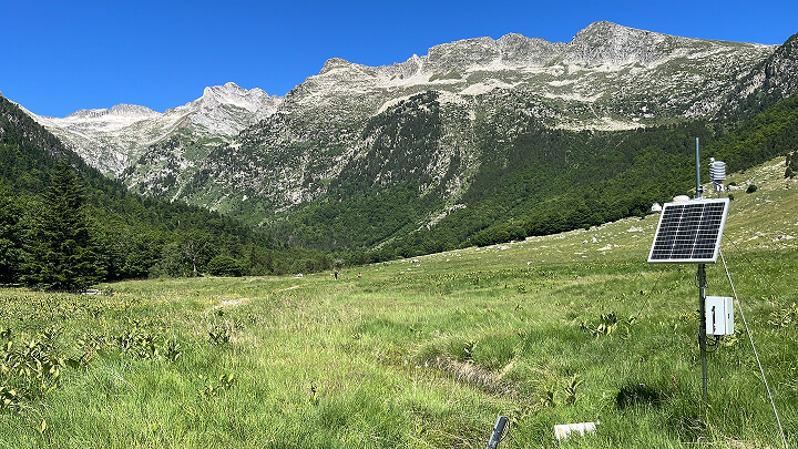
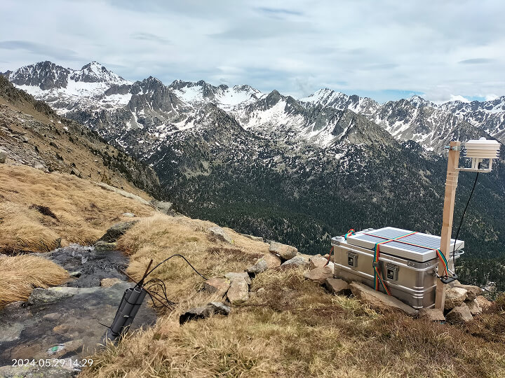
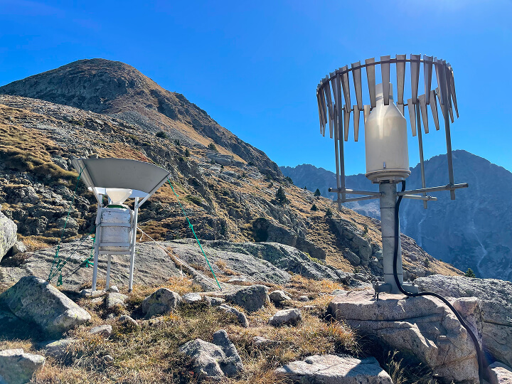
Sensor-based monitoring represents one of LOOP’s most recent innovative goals, aiming to leverage cutting-edge sensor technologies to capture the rapid and non-linear mechanisms underlying the transfer and cycling of water and biogeochemical elements across landscape compartments — from the atmosphere and soils to groundwater and surface waters. This approach provides continuous, high-frequency measurements of key environmental variables, enabling the detection of short-term dynamics and improving understanding of the processes that drive hydro-biogeochemical and ecological change in inland waters.
Sensor-based monitoring
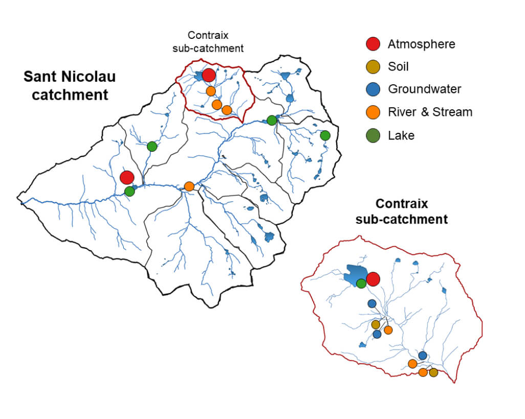
| Habitat | Sampling activity | Specifications | Stations (n) |
|
Atmosphere |
Meteorology | Temperature, precipitation, radiation, relative humidity | 3 |
| Particle Matter | PM10, PM2.5 | 1 | |
| GHGs | CO2 | 1 | |
|
Soil |
Water level | Shallow pizometer (from 0 to 100 cm) | 3 |
| Water content | Soil mositre measured at 3-4 depths | 3 | |
| Water physical properties | Temperature, electrical conducitvity | 3 | |
| GHGs | CO2, O2 | 3 | |
|
Groundwater |
Water level | Deep pizometer (from 1 to 20 m) | 3 |
| Physical properties | Temperature, electrical conducitvity | 3 | |
| GHGs | CO2, O2 | 3 | |
|
River / Stream |
Water level | Gauging station (discharge derived from rating curve) | 5 |
| Physical properties | Temperature, electrical conducitvity, turbidity | 3 | |
| Chemical properties | Colored dissolved organic matter (CDOM) | 3 | |
| GHGs | CO2, O2 | 3 | |
|
Lake |
Water level | Water level measured at the shore | 6 |
| Physical properties | Thermistor–oxygen sensor chain | 6 |
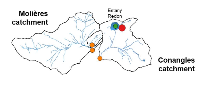
- DISCRETE WATER SAMPLING
The Discrete Water Sampling component of the LOOP program comprises three distinct types of field campaigns, each designed to capture complementary aspects of aquatic ecosystem dynamics. Details of each campaign are provided below.
Monthly or regular sampling scheme
Regular sampling consists of monthly field campaigns (5-6 days) to provide consistent time series of key chemical and biological parameters.
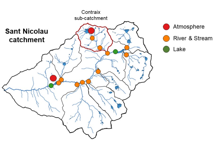
| Habitat | Sampling activity | Specifications | Stations (n) |
| Atmosphere | Precipitation chemistry | aSet of chemical parameters analyzed at the ECAM Lab | 2 |
| River / Stream | Chemistry | aSet of chemical parameters analyzed at the ECAM Lab | 14 |
|
Lake |
Physics | CTD-O2, Secchi depth | 1b |
| Chemistry (lake outlet) | aSet of chemical parameters analyzed at the ECAM Lab | 3c | |
| Chemistry (water column) | aSet of chemical parameters analyzed at the ECAM Lab | 1b | |
| Biology (water column) | Zooplankton, Phytoplankton, Rotifers | 1b |
a pH, alkalinity, major ions (Ca²⁺, Mg²⁺, Na⁺, K⁺, Cl⁻, SO₄²⁻, HCO₃⁻), nutirents (NO₃⁻, NH₄⁺, PO₄³⁻, total N, total P), carbon species (DOC, DIC, TOC, pCO₂), DOM composition, trace and ultratrace elements (Fe, Mn, Al, Cu, Zn, etc).
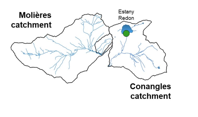
b Estany Redon (Lake water column sampling is conducted at 2, 10, 20, 35 and 60 m depth)
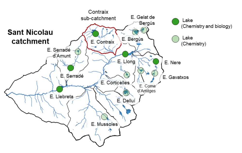
c Estany Redon, Estany de Llebreta, Estany Llong
Seasonal sampling scheme
Regular sampling consists of monthly field campaigns (5-6 days) to provide consistent time series of key chemical and biological parameters.
| Habitat | Sampling activity | Specifications | Stations (n) |
|
Lake |
Chemistry (lake outlet) | aSet of chemical parameters analyzed at the ECAM Lab | 14 |
| Biology (water column) | DNA at epilithic biofilm and water column | 6 |
a pH, alkalinity, major ions (Ca²⁺, Mg²⁺, Na⁺, K⁺, Cl⁻, SO₄²⁻, HCO₃⁻), nutirents (NO₃⁻, NH₄⁺, PO₄³⁻, total N, total P), carbon species (DOC, DIC, TOC, pCO₂), DOM composition, trace and ultratrace elements (Fe, Mn, Al, Cu, Zn, etc).
Annual sampling scheme
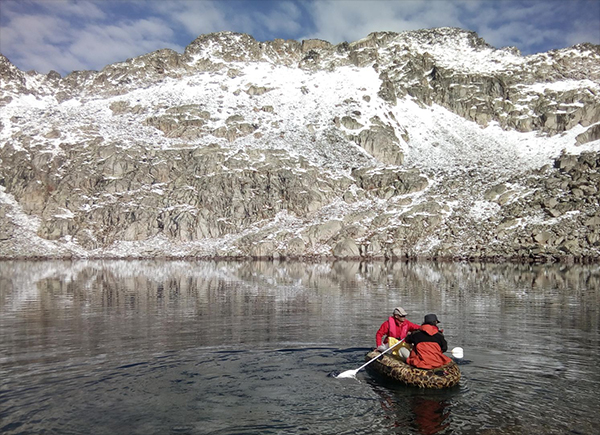
Annual sampling is conducted once a year at six reference lakes (Estany Redon, Estany de Llebreta, Estany Llong, Estany de Serradé, Estany de Contraix, and Estany Nere). This sampling focuses on the maintenance of the thermistor chain and the collection of the sediment traps placed at the bottom of each of these lakes.